
About the park
Kidepo Valley National Park: Uganda's far-northern wilderness
Two broad valleys ringed by mountains, in the corner of Uganda where South Sudan and Kenya meet. Kidepo was gazetted in 1962 to protect its great herds, and it remains the country's least visited savannah park: around 7,400 visitors a year, under two per cent of Uganda's total.
If you only want the answer
Uganda's remotest park, pressed against South Sudan, where a single watered valley carries the game through the dry months. Hard to reach for fifty years, and that is exactly what it sells now.
Two valleys, one waterhole of a park
Kidepo covers 1,442 square kilometres of semi-arid savannah between 914 and 2,750 metres, roughly 700 km from Kampala in the Karamoja sub-region. South Sudan lies along its north-western edge and Kenya just five kilometres to the east. First protected as a game reserve, it was upgraded to national park in 1962, Uganda's third savannah park, created mainly to protect the large herds of buffalo, zebra, elephant and the carnivores that hunt them.
The geography explains everything about a visit. Two broad, shallow valleys are drained by seasonal sand rivers: the Narus in the south, whose name means muddy area in Karamojong, and the Kidepo in the north. Both flow only after rain in the Morungole mountains. As the dry season bites, the Narus Valley's remnant pools become the only permanent water in the park, and the wildlife, the lodges, the road circuits and the headquarters at Apoka all concentrate there. The northern Kidepo Valley, with roughly 635 mm of rain a year against the Narus Valley's 890 mm, stands dry and almost empty most of the year, which is exactly its appeal.
The least visited park in Uganda, by the numbers
The remoteness is measurable. In UWA's last published annual report, for FY2022/23, Kidepo recorded 7,393 visitors, about 1.9 per cent of Uganda's 382,285 park visits that year. Murchison Falls took 145,116 and Queen Elizabeth 97,814 in the same period, so Kidepo sees roughly one visitor for every twenty at Queen Elizabeth. It was also the only protected area in the country whose numbers fell that year.
For the visitor this cashes out simply: you can spend a full day on the Narus circuits in high season and meet a handful of other vehicles, in scenery that regularly gets compared to the great Kenyan and Tanzanian parks. No UWA annual report newer than FY2022/23 has been published, so these remain the most current official figures.
The mountains around the rim
Kidepo's horizon is all mountains. The Morungole range rises north-east of Apoka, home of the Ik people, with UWA giving the peak as 2,570 metres. Mount Zulia, Pirre, Lonyili and Morunyang stand along the other edges, and on the clearest days the Kidepo Valley drive looks across the border to Jebel Lotuke in South Sudan at 2,975 metres. The Lomej and Lonyili hikes, and the walking trails on the Narus side, put you into this country on foot with a ranger.
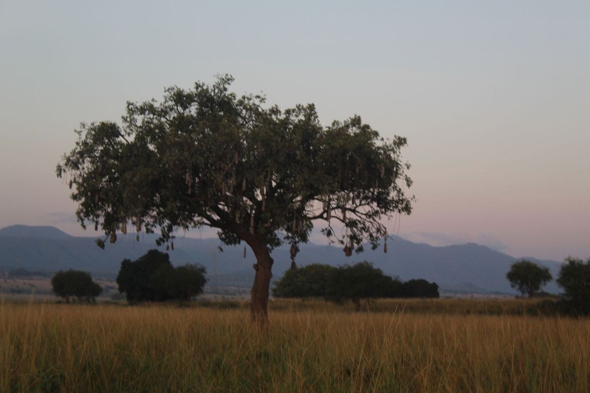
The park and its neighbours
Kidepo sits inside a working cultural landscape, not an empty one. The Karamojong graze and farm the plains around the park, the Ik farm the Morungole slopes, and 20 per cent of all park fees is shared with the parishes along the boundary, a disbursement worth UGX 400 million in FY2022/23. The adjacent Karenga Community Wildlife Area operates its own licensed tourism, and community walks, manyatta visits and Karamojong crafts are a genuine part of a Kidepo itinerary rather than an afterthought.
Security questions come up with every Kidepo plan, and deserve a straight answer. Karamoja saw serious cattle-raiding insecurity in the early 2020s, and the UK FCDO still reports armed raids in the wider region, while not advising against travel to Karamoja or Kidepo and noting that foreign nationals are not usually targeted. Tourism operates normally. The one precaution every source shares: do not drive at night.
Choosing between Kidepo and Murchison Falls?
Uganda's two great savannah parks end up on the same shortlist, and we run the guides to both. Our sister guide carries the full side-by-side comparison, species by species and shilling by shilling: Murchison Falls or Kidepo. The one-line version: Murchison for a first Uganda trip, the boat and the falls; Kidepo if you have been, want the emptiness, and the long road north is part of the point.